Concerns over roadway safety in West Vancouver are being raised after a tragic collision claimed the lives of two people and sent three others to hospital last week.
At around 11:40 p.m. on June 26, a driver travelling eastbound in the westbound lanes on Highway 1 near Westport Road caused a head-on collision, West Vancouver police said.
Two people were declared dead at the scene, and three were sent to hospital with “serious but non-life-threatening injuries,” said Sgt. Chris Bigland, spokesperson for West Vancouver police. Bigland said police couldn’t specify which people were in what vehicle when the crash happened.
“West Vancouver Police Department extends our deepest condolences to the family and friends of those impacted and thanks the West Vancouver public for their patience and co-operation,” WVPD said in a statement following the incident.
The Integrated Collision Analysis and Reconstruction Service was called to the scene to investigate, as first responders worked through the night to clear the scene of the crash.
A closure of all highway traffic bound for Horseshoe Bay and the Sea to Sky west of Exit 4 near Caulfeild Drive continued through Friday morning. Westbound vehicles had to be re-routed through municipal roads, which caused heavy delays throughout the day for passengers at the nearby BC Ferries terminal.
In the days following the collision, the North Shore News has received numerous emails and phone calls expressing concerns over roadway safety in West Vancouver.
In particular, residents have pointed to the adjacent off- and on-ramps at Exit 4 near Caulfeild, as well as a detour route for traffic leaving Horseshoe Bay via Marine Drive, as being potential problem areas.
Brett Davidson, a construction site flagger who lives in the Gleneagles area, said he contacted both the District of West Vancouver and the Ministry of Transportation two weeks ago after noticing that the Marine Drive detour could be confusing for drivers.
'Design of and clarity of highway signage is critically important'
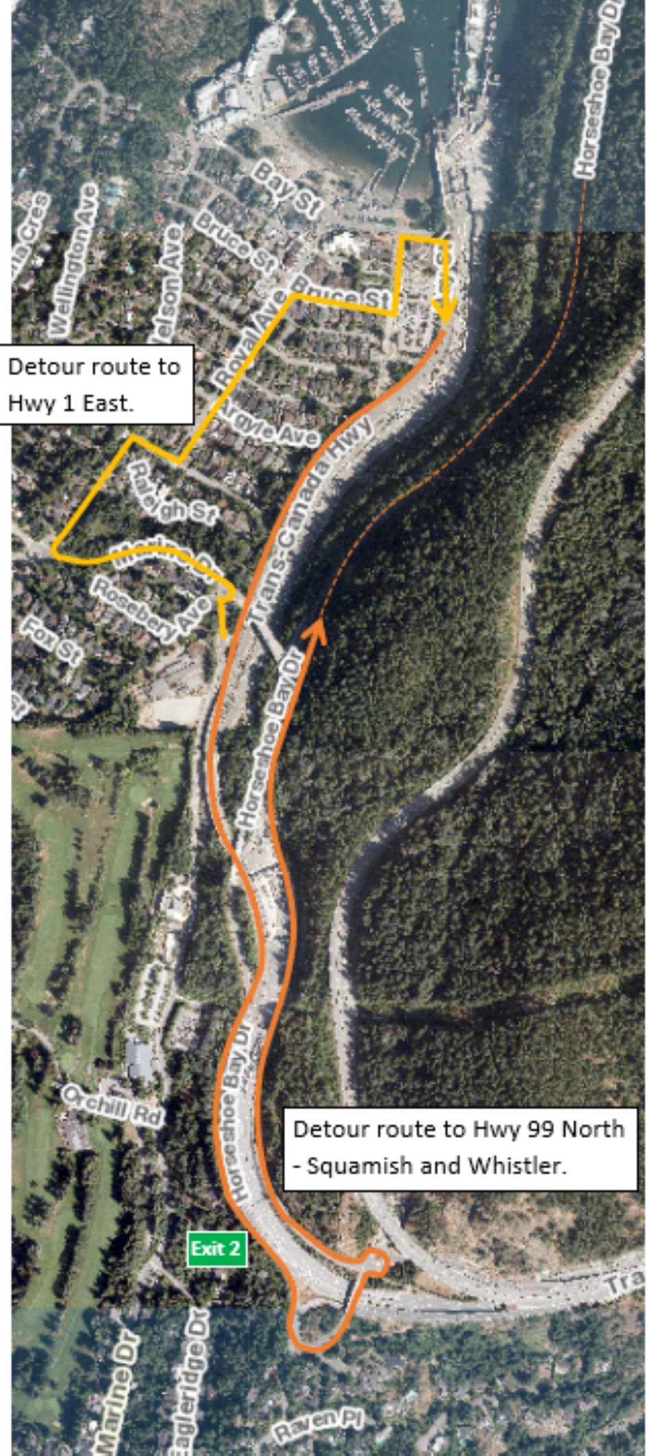
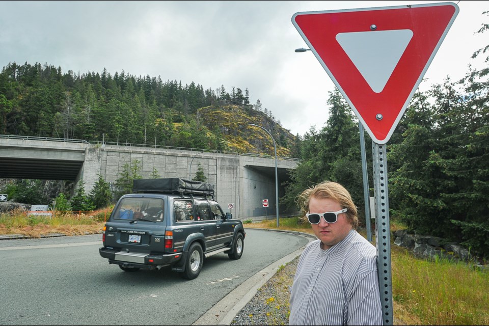
Currently, the overpass that would take traffic over Highway 1 onto Horseshoe Bay Drive and Highway 1 eastbound is closed for a seismic upgrade. As a result, many drivers are using Eagleridge Drive at Exit 2 to get back on the highway. For drivers wanting to access the old highway toward Squamish, Highway 99, a signed route directs them to travel through Horseshoe Bay and turn around at Exit 2.
While there are signs at Exit 2 that say Do Not Enter, to prevent drivers from going onto the westbound highway, it can still be confusing, especially in dark and wet conditions like the time of the recent crash, Davidson said.
“The detour route has to be simple enough that people who people can understand, even like a child can understand it. You have to give them every direction,” he said. “That was not done.”
Sydney Sharpe, who has lived in West Van for 25 years, said highway signage in the district could be larger and more clear.
“There have been two recent incidents of someone driving the wrong way on Highway 1,” she said. “I have noticed that the signage around Highway 1 on-ramps and off-ramps in some cases is confusing. I think that the design of and clarity of highway signage is critically important.”
In a written statement, the District of West Vancouver extended sympathy to the everyone affected by the tragic crash. The municipality added that road safety is of the “utmost importance to us, and we take all incidents seriously.”
“At this moment, the cause of the accident is under investigation by multiple agencies, including the Integrated Collision Analysis and Reconstruction Service (ICARS),” said Natalie Roizman, district spokesperson.
“When the Horseshoe Bay underpass seismic safety upgrade project and associated traffic control and detour plan was first implemented, the District of West Vancouver heard from a handful of residents with questions about the signed detour route,” she said. “The DWV forwarded the comments to MoTI and their project manager for their consideration.”
According to the Ministry of Transportation and Infrastructure, the signed detour route doesn’t direct people to the Upper Levels Highway via Eagleridge Drive. “Rather, the detour directs traffic to the highway via Horseshoe Bay to access the highway adjacent to the ferry terminal,” a statement from the ministry read.
“Immediately following the incident, ministry staff thoroughly reviewed all nearby highway access points and confirmed all signage was in place and clearly visible,” the statement continued. “The project team, in consultation with District of West Vancouver, is installing additional detour signage in connection with the construction project to ensure directions are clear.”
The seismic upgrade project is expected to finish in January 2025.


