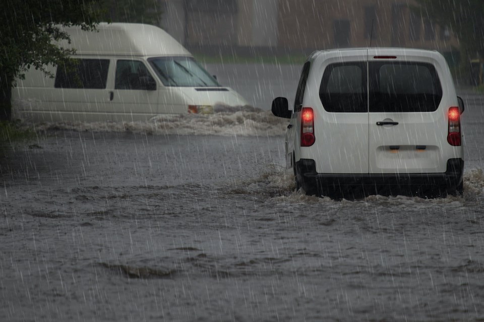
The Metro Vancouver weather forecast includes an atmospheric river expected to drench the B.C. coast for up to 36 hours.
Environment Canada meteorologist Armel Castellan says locals should brace for a significantly wet weekend as an atmospheric river brings rainfall to southern B.C. starting Friday morning.
The Lower Mainland is expected to receive intermittent rainfall starting Wednesday but the "more potent signal" shows heavy rain starting Friday morning and into the afternoon.
"This is the first telltale atmospheric river," he tells V.I.A., noting that B.C. has already seen about six of them this season. These stormy events were focused on Vancouver Island and northern B.C., meaning Metro Vancouver was spared most of the impacts.
While atmospheric rivers can wreak devastation, such as the floods of November 2021, most of them aren't destructive. They also aren't rare, with the Lower Mainland seeing anywhere from 20 to 30 annually.
The weather models don't indicate that this atmospheric river will be particularly potent but it is still too early to say how it will unfold. Castellan notes that the 2021 event "wasn't clear until it was on the doorstep." Meteorologists could see the storm approaching but did not gauge its intensity until closer to impact.
However, a few factors mean this event doesn't have as much potential to be as destructive as the 2021 flooding — even if the system brings abundant rainfall over a long period.
Metro Vancouver weather has been fairly dry
Since it has been fairly dry for the past 30 to 45 days, the hydrological system can absorb more precipitation than it could if Metro Vancouver had already received significant rain this fall.
"There is a lot of room," says Castellan.
Other places across the province can't absorb significant rainfall because they've already received so much, including areas along the Central Coast such as Bella Bella.
Castellan adds the 2021 weather event also included significant snowmelt of at least 100 mm on top of the 250 to 300 mm of rainfall. Current snowpacks aren't high enough to produce the same 2021 impacts, as this event is slated a month ahead of the former event.
Atmospheric rivers are "narrow bands of heavy precipitation" that track north and south, meaning they only have to change course slightly and could miss a region entirely.
"They are about 100 to 200 km in width compared to storms that stretch across half or even two-thirds of the province," he remarks.
The first atmospheric river of the season can cause damage
While the signal isn't showing a powerful storm, the first atmospheric river of the year always carries a potential for damaging impacts.
"Any strong atmospheric river can cause problems because the environment hasn't been tested in this way," Castellan says.
The storm system is expected to slump south into the Olympic Peninsula and Oregon by Sunday morning. Metro Vancouver should see heavy rainfall ease by Saturday evening, although the timing and intensity of the event remain uncertain.
Castellan adds that these events can cause more damage when they hit one part of the coast and "stall for 48 hours." Wind typically isn't a significant factor in these events but some strong winds are expected.
Since there haven't been major windstorms in the Lower Mainland this season, powerful gusts could cause power outages and damage trees.
"It is a bit too early to say exactly what will happen but we are looking at it closely with our partners."
Stay up-to-date with hyperlocal forecasts across 50 neighbourhoods in the Lower Mainland with V.I.A.'s Weatherhood.


