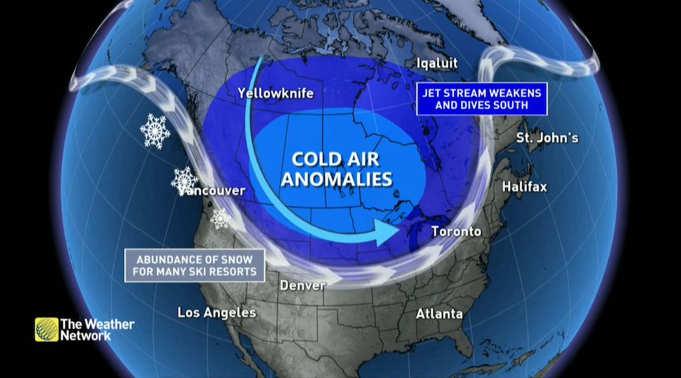
Metro Vancouver could see temperatures fall below seasonal averages in the coming weeks thanks to a weather disruption high above the Arctic.
The Weather Network says the majority of Canadians could see a range of cold weather anomalies due to a disruption in the weather pattern high above the Arctic called a "stratospheric warming."
A sudden stratospheric warming (SSW) occurs when storms disrupt the" upper-level circulations over the highest latitudes of the Arctic," causing the winds to change direction and allowing the stratosphere to "dramatically warm up."
The stratosphere is an area located roughly 30 km above the ground, which is much higher than commercial planes fly.
A SSW event can set off a "chain reaction" that affects our local weather for multiple weeks and disrupts the polar vortex -- the "broad upper-level circulation over the far northern latitudes that grows to its peak strength in the winter," according to the weather channel's report.
The sudden stratospheric warming can affect the Metro Vancouver weather forecast
Typically, the polar vortex keeps the coldest air confined to the Arctic. When the weather pattern is disrupted, however, "troughs and upper-level lows spun off from the main circulation can send those frigid temperatures plummeting toward lower latitudes."
These blasts of bone-chilling air can reach the biggest cities across the country, located in the southernmost parts of the provinces. While it will take some time for this "North Pole warmup" to affect temperatures at surface level, The Weather Network's current models indicate a possible widespread deep freeze.
While each SSW event is unique, there is a potential for "colder-than-normal temperatures plunging southward" in various regions, including southern B.C.
The Weather Network advises Canucks: "Don't rush to put away those heavy coats or shovels just yet."
Environment Canada is currently calling for a colder spring in the Lower Mainland. Have a look at the complete seasonal forecast.


