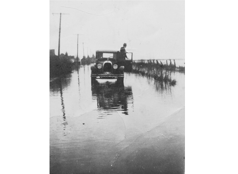
There’s been a lot of changes over the years in Delta including leaving behind now mostly forgotten former names of many of its roadways.
A few of them include Point Roberts Road (now called 56th Street), Raitt Road (12th Avenue), Tasker Road (80th Street), Patrick Road (81A Avenue), Brandrith Road (16th Avenue), Victoria Street (47th Avenue), King Edward Street (45th Avenue), Ontario Street (48B Street), McDonald Road (88th Street), Parmiter Road (34B Street), Green Road (57th Street), G.B Main Road (41B Street), Hellings Road (86th Avenue) and Cemetery Road (8th Avenue), among others.
Here’s a few others that used to go by different names in yesteryear:
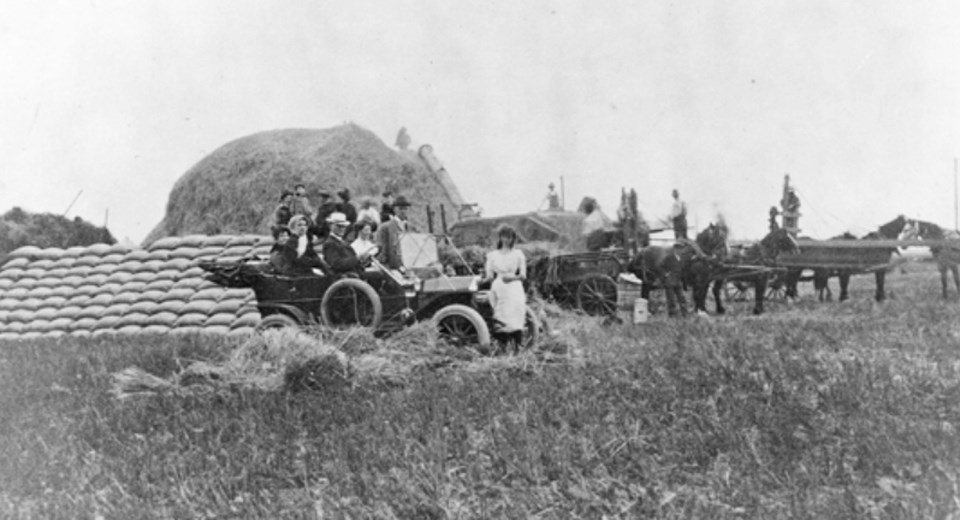
This Delta Archives photo shows a group of farmers in 1910 haying at the John Harris farm. It was located on Vasey Road in Ladner. Vasey Road would later be renamed 60th Avenue.
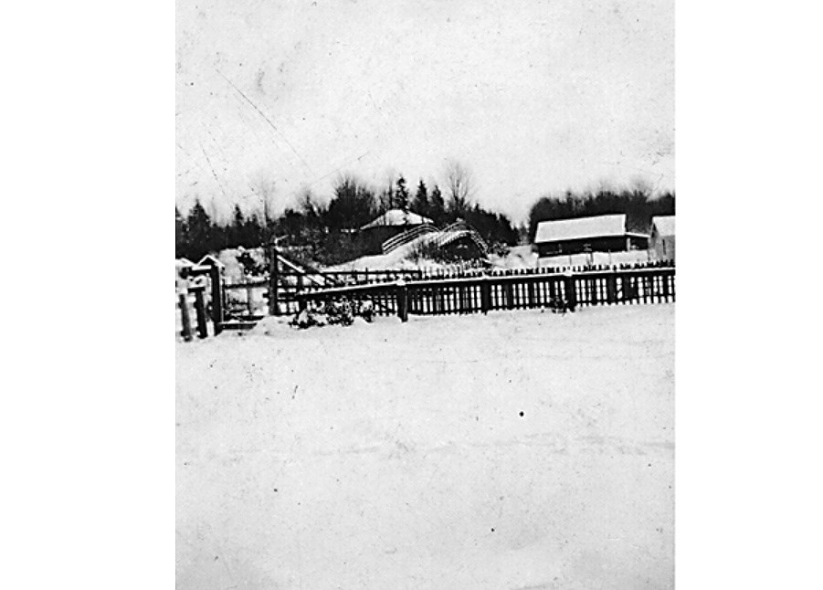
A photograph from the 1920s of the Peck Road bridge crossing over the GNR railway tracks. The Mosher Siding School was in the building on the right of the bridge. Peck Road in what's now know as the Sunshine Hills neighbourhood would become 64th Avenue.
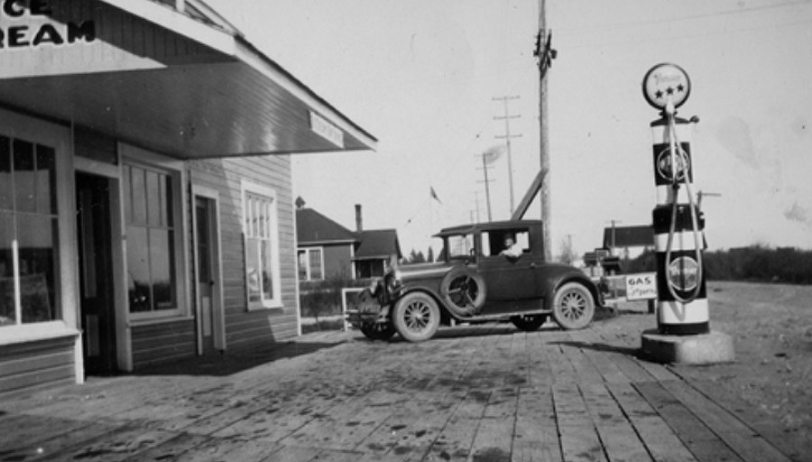
A 1930s picture of Butler's store and gas station at the corner of Ladner Trunk Road (Highway 10) and Mathew Road, which is now called 96th Street. The store is now the location of a Tim Horton's.
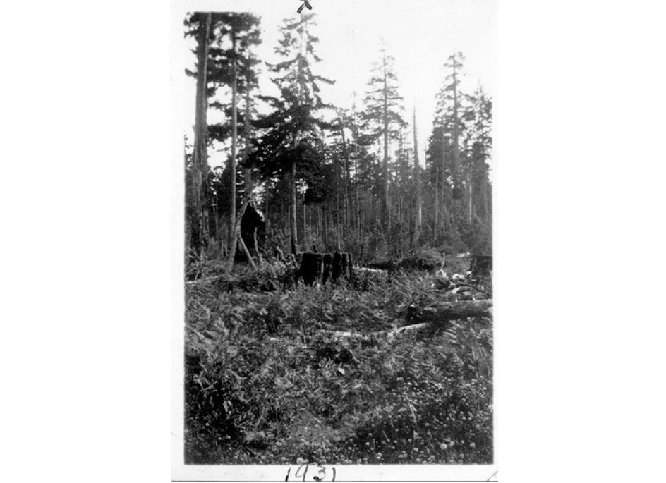
A 1931 photo showing forest covered land on Allen Road in Boundary Bay that was purchased by William Dennison. The road is now called 6th Avenue.
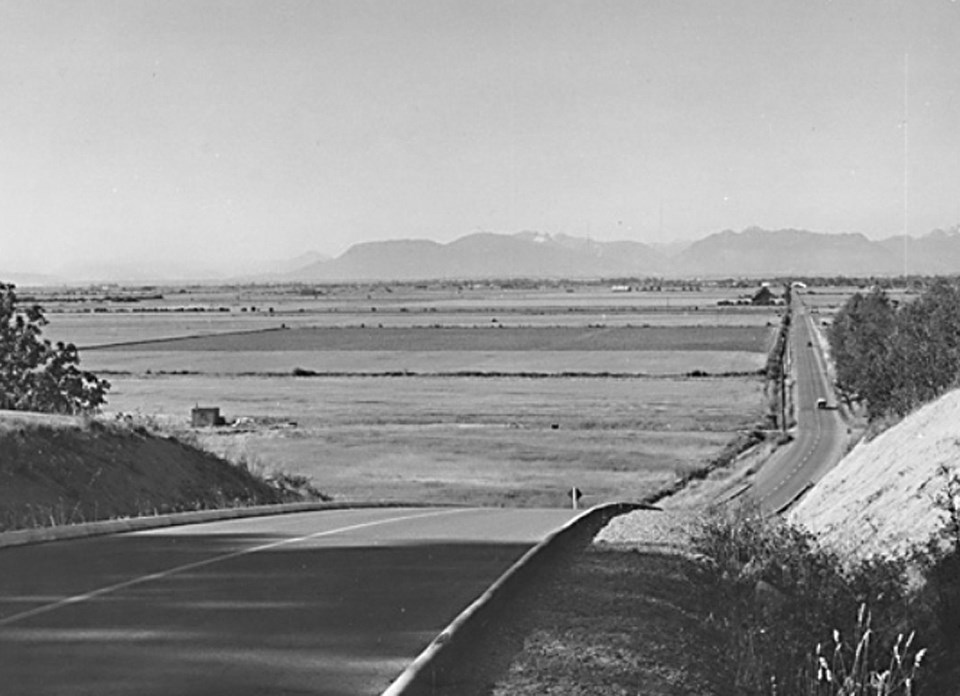
A photo from the 1950s showing Imperial Road looking north, showing the Brandrith farm to left. The farm is now a golf course and Imperial Road is now 52nd Street.
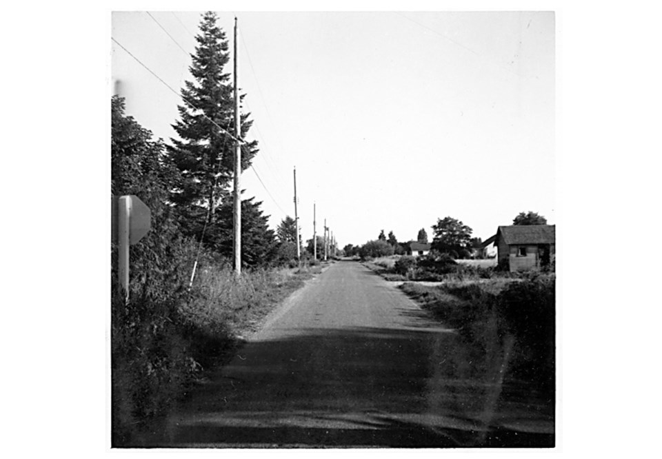
A 1958 photograph of a view southward down Maple Road from Trunk Road. The photograph was taken by William Fisher in July 1958. Maple Road is now 53rd Street.
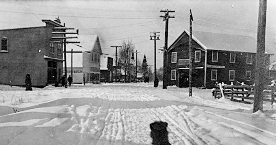
A Delta Archives photograph taken in the winter of 1910 from the bridge crossing Chilukthan Slough at the corner of Trunk Road and Slough Road, now Elliott Street on right and Arthur Drive on left. It’s looking west, down Westham Street, now called 48th Avenue. Businesses shown on either side of Westham Street include Stokes Meat Market, the White Store and Peter Clark's blacksmith shop.
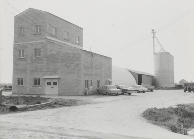
A 1950s photo of the BC Sugar processing centre in Ladner on 40th Street (formerly Wellington Road) and River Road West.
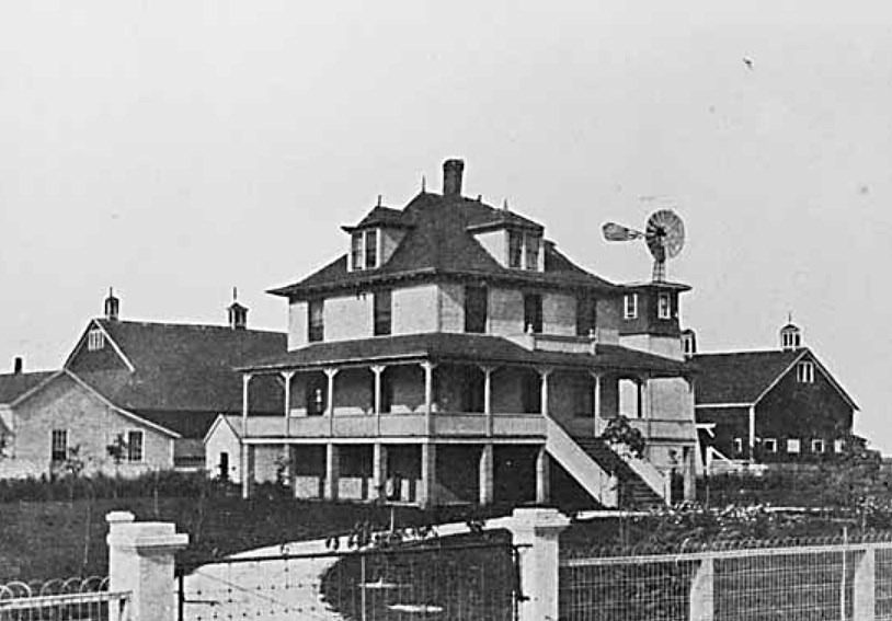
A 1908 photo of the manager's house on the Burns Ranch, located at the corner of Ladner Trunk Road and Heath Road, which is now 72nd Avenue.
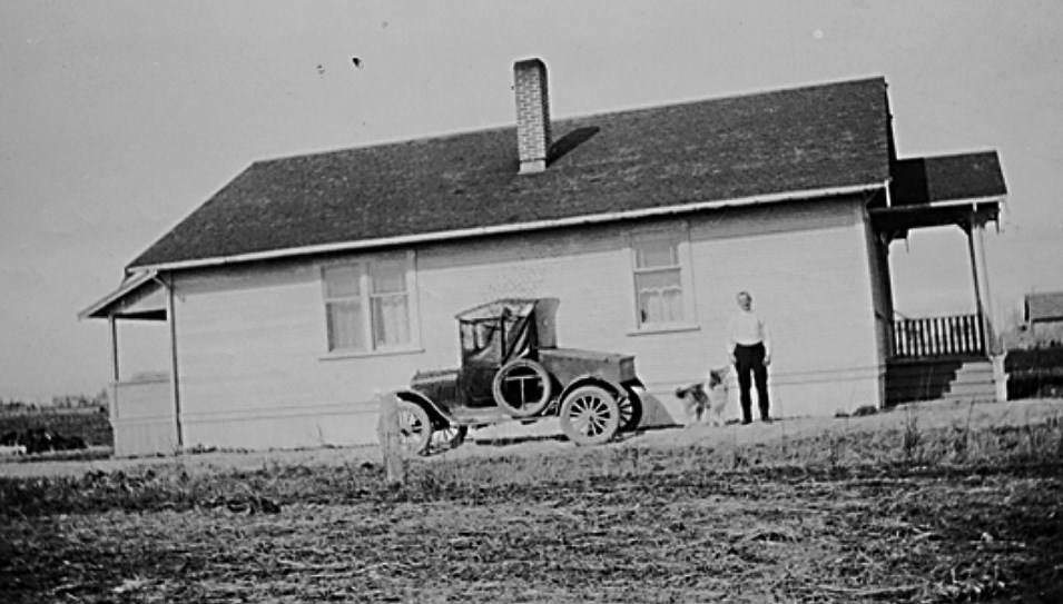
A 1929 photo of Stan Reynolds and dog Buster at the family home on Reynold’s Benson Road farm. Benson Road is now 76th Street.
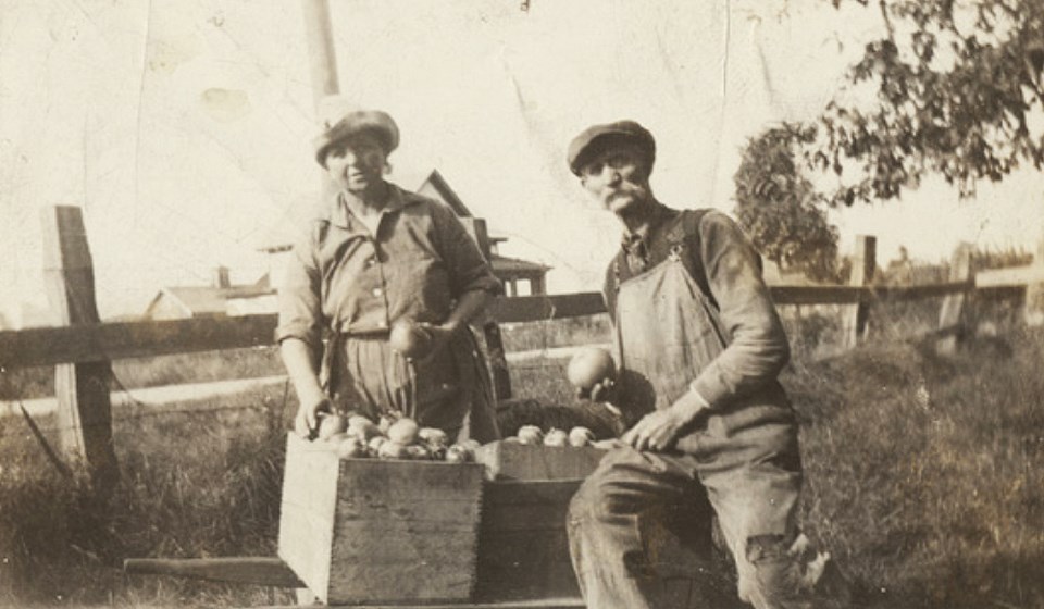
A 1920's photo of Mr. and Mrs. Bill Holman with their apple crop on Fairview Road, later renamed 46A Street.
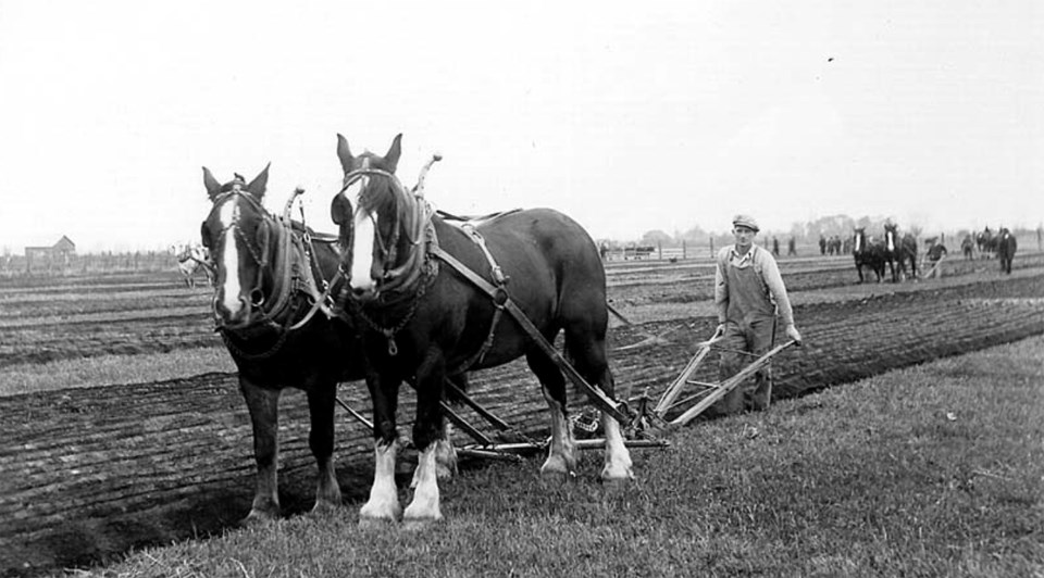
A November 1928 Delta Farmers' Institute plowing match held on William E. Stokes' farm.The field was located near Goudy Road (now 64th Street) and Trunk Road, where Highway 17 now runs north.
The city is gradually adding markers to its streets that have been renamed (most of them renamed numerically) through the historic street marker program. The heritage advisory commission decides which streets should have markers and makes recommendations to council every year.
Commission members recently noted the importance of the program to provide continuity and build a connection between the past and present of the city.
